Red Eft Mapping
Mural Sized Appalachian Trail Maps on Canvas
Whether you have hiked just a few steps on the Appalachian Trail, have thru-hiked the whole enchilada or dream of doing so one day, you probably landed here because of your fondness for this iconic American trail.
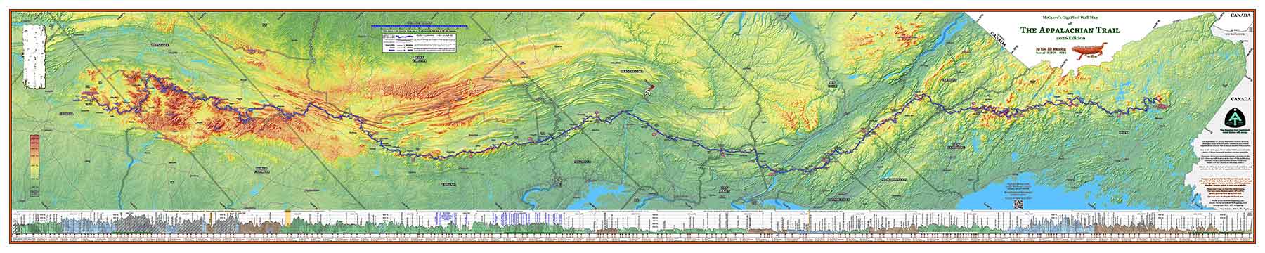
Our maps show the entire A.T. including the southern Approach Trail, and also include an elevation profile of the entire 2,197.9 mile trail (2026 official mileage) which locates hundreds of geographic landmarks along the trail. They were engineered by a credentialed land surveyor, cartographer, and A.T. thru-hiker who has hiked every foot of the trail. These are not a corporate-produced map without heart.
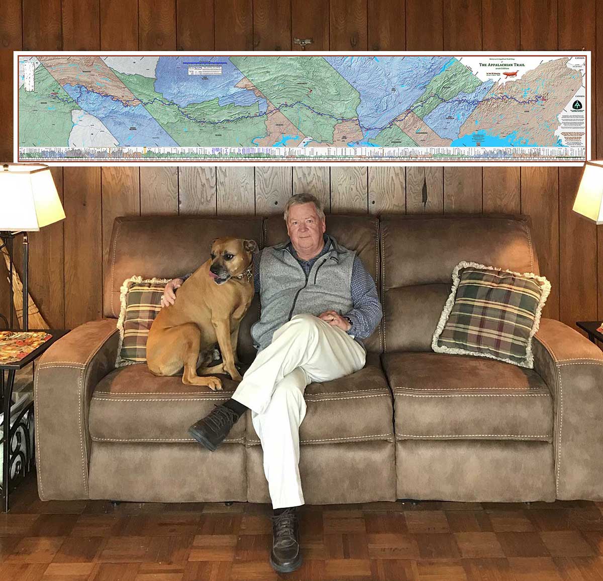
Each map is a piece of art worthy of your home, office, man-cave, she-shed, gallery, or hiking museum. The maps are a 10 feet wide x 2 feet tall panorama format, printed on professional canvas with archival inks – they will last a lifetime. Whether standard or customized, this map shows incredible terrain detail, containing over a billion pixels, and is designed and printed in the USA on the very highest quality USA-made professional canvas. Local is good.
Our maps also feature a custom map projection which renders the entire length of the A.T. with omnidirectional scale factor errors of less than 0.01%. It is the most accurate projection ever devised for the Appalachian Trail as a whole.
Standard edition, year 2026 Appalachian Trail Maps on Professional Canvas – 10′ x 2′ – Ready to ship.
See shop page at bottom.
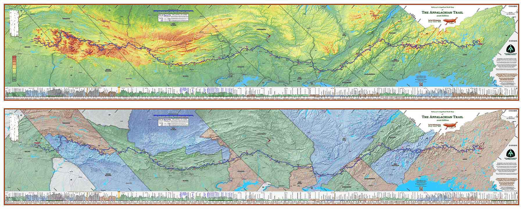
Our standard maps are available in two color schemes (shown above).
The maps are mural-sized – 10′ wide x 2′ high maps of the entire Appalachian Trail (A.T.), oriented so that you can see the entirety of the A.T. at eye level and get close to see the incredible terrain detail.
There are over a billion pixels in this map and you will love seeing the topography of the terrain and the geologic folding of the great Appalachian mountain chain.
These maps contain an updated elevation profile of the entire 2,197.9 mile trail (2026 Appalachian Trail Data Book mileage), as well as all current shelter locations.
More information is available on the standard maps detail page.
Our Specialty: Fully Customized 10′ x 2′ Appalachian Trail Maps for A.T. Hikers, on Professional Canvas.
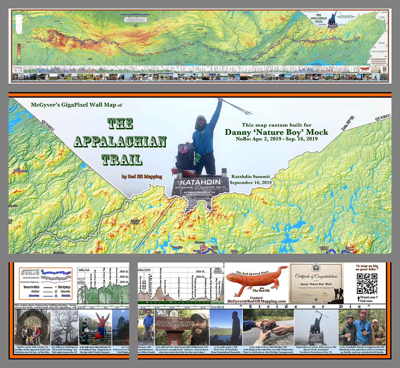
Our specialty is highly customizing our “standard” map for Appalachian Trail hikers with their favorite trail photos and captions, a timeline of their hike, and several other available customizations including background coloring and any other ideas that the hiker might dream up. If you can describe it, we are happy to make it part of your map.
Like our standard maps, our customized maps are printed on professional canvas using archival inks, and will last a lifetime.
Designed and printed in the USA by A.T. thru-hikers – we speak your language.
More information is available on the custom maps detail page.