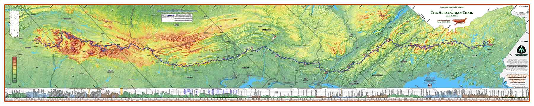
Full-Custom AT Maps
Our specialty is making full-custom maps of the A.T. for former thru-hikers, section hikers, or anybody else who wants to put their spin on our map. Even though we sometimes spend weeks on the customizations (depending upon how much interaction we have regarding options and color, etc), we only charge a modest amount over the standard map pricing. Crazy! We enjoy doing this so cheaply as a way of giving back to the incredible A.T. hiker community.
The typical customizations we have done in the past include, but are by no means limited to:
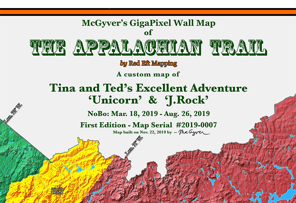
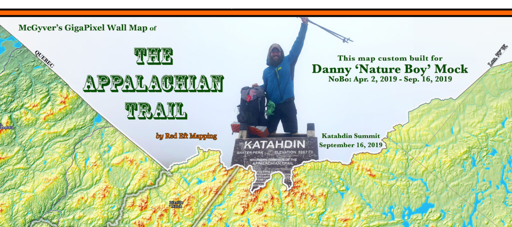
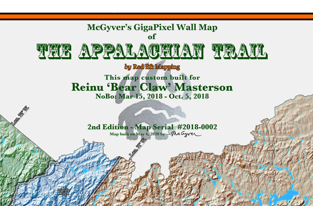
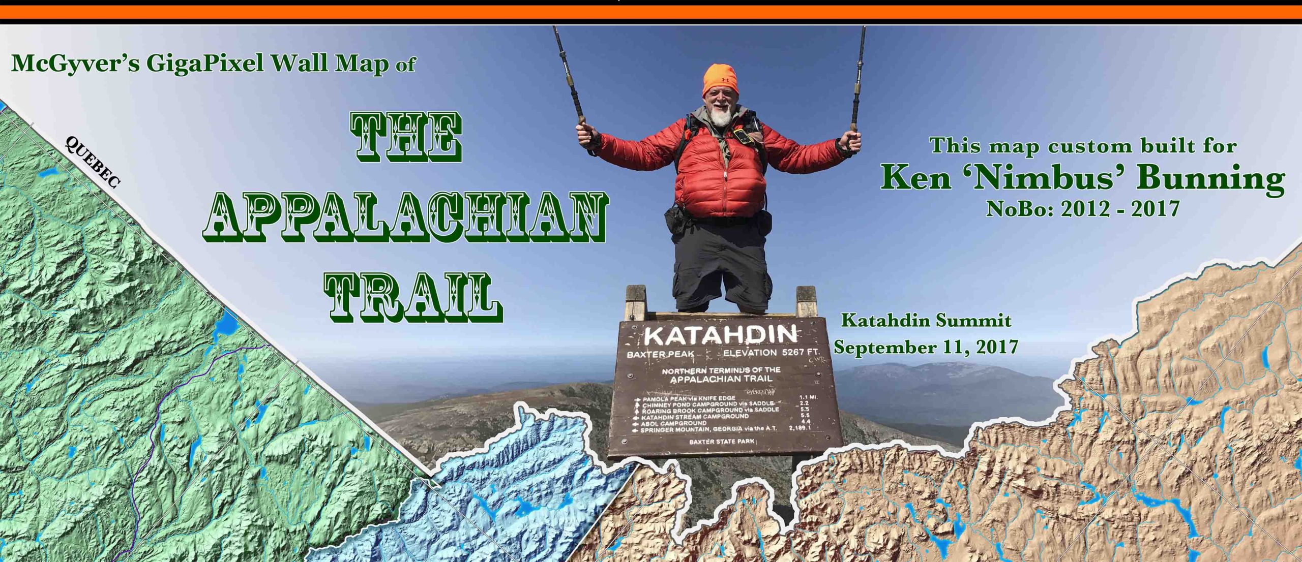
A custom title block with your name, trail name, Springer and Katahdin summit dates, and hike style (NoBo, SoBo, Flip-Flop, or Section). Your map will also have a unique serial number. Shown below are three examples of custom title blocks we have done for hikers:
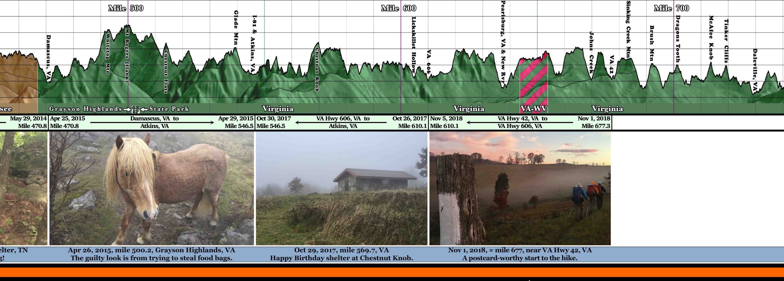
Your “PhotoBar” tells your AT story. The PhotoBar is a strip of roughly 50 of your favorite trail photos, located on the bottom of the map below the elevation profile.
The PhotoBar extends the full 10′ width of your map, and below each photo is a space for captioning the photo.
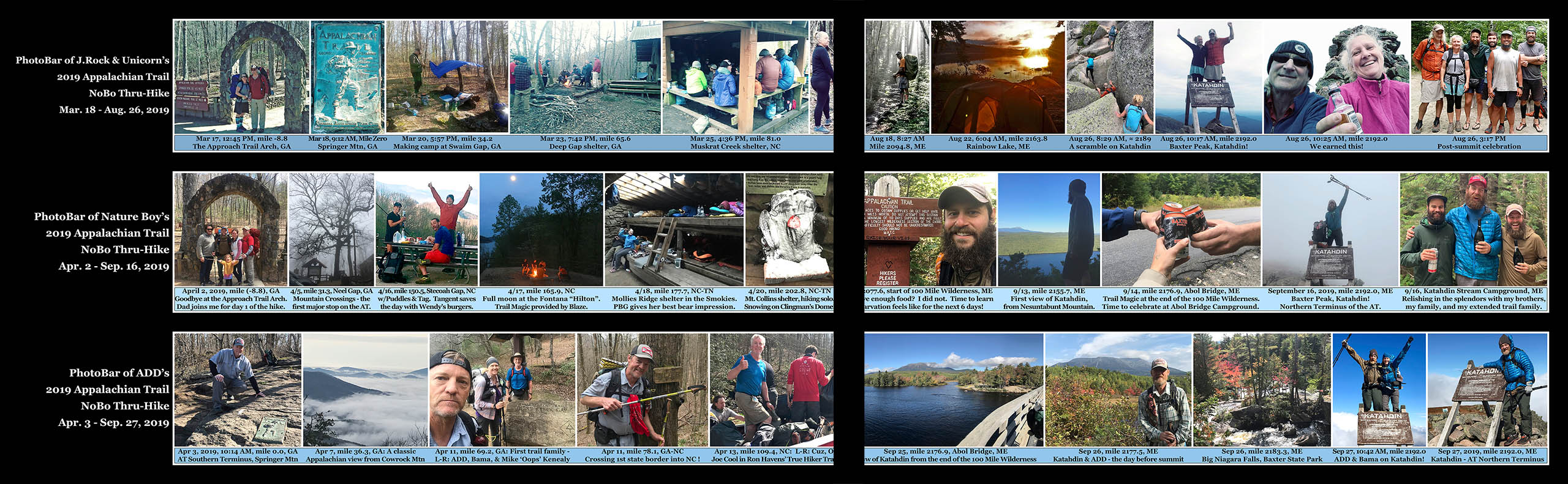
Captioning usually includes the photo date, A.T. trail mile, two-letter state abbreviation, and whatever else you might want to say about the photo. Bonus points given for humorous or snarky captions.
The photos will each be 2″ tall on the map. They will bring back your favorite trail memories, and also help you tell your friends what it is really like to hike the A.T.! (Cold, heat, bugs, blisters, hunger, thirst, pain, mud, ticks, snakes, & bears). But also joy, beauty, kindness, peace, fresh air, and friendships.
To see the complete PhotoBars of the hikers above in Zoomify or movie form, visit the PhotoBar detail page.
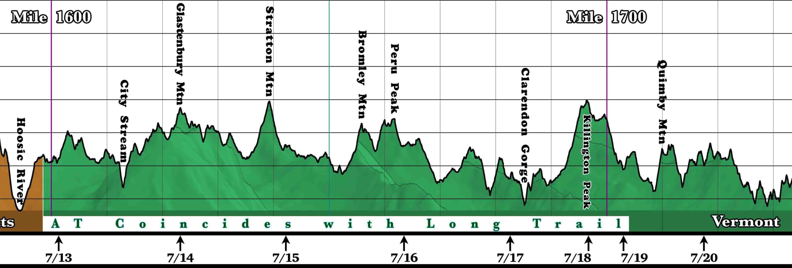
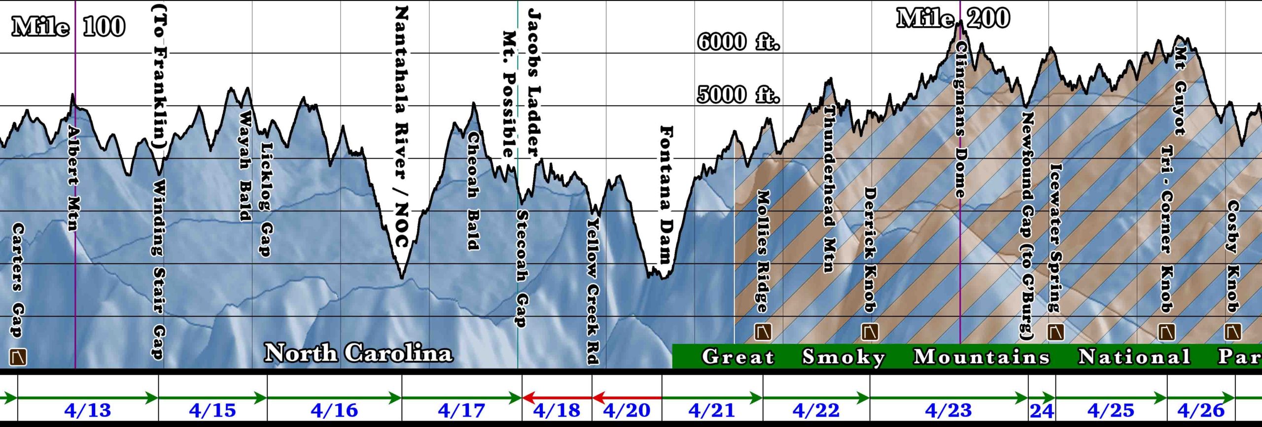
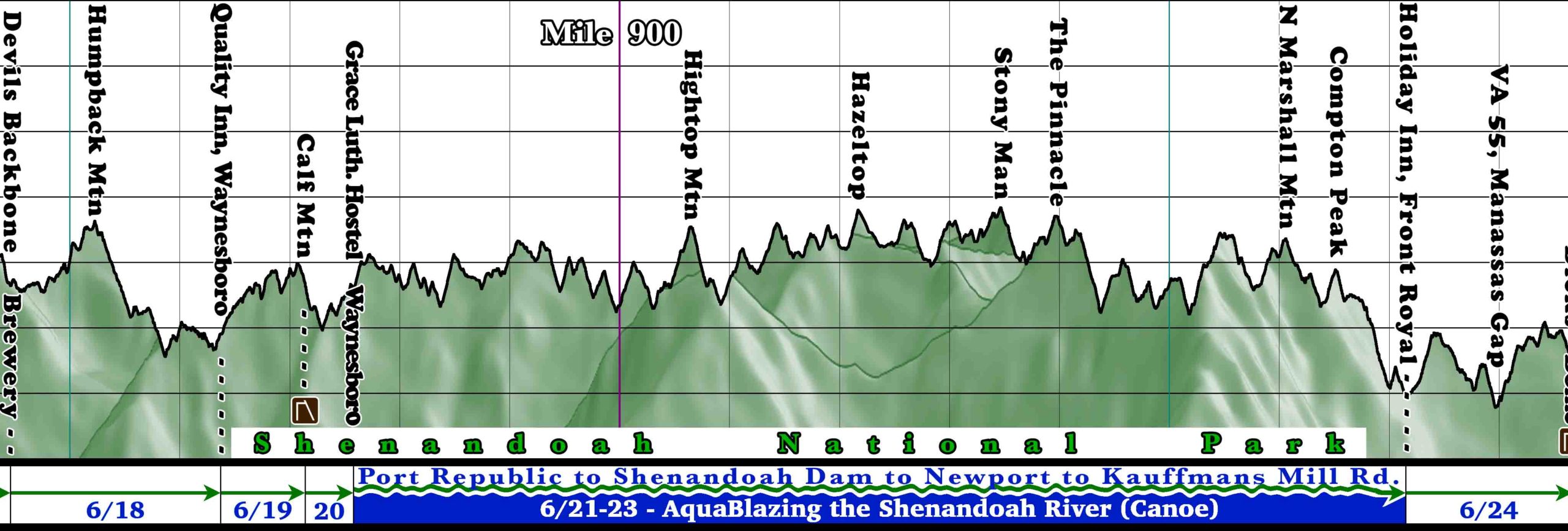
If you kept a journal of where you hiked each day, we can also put a TimeLine Bar on the map, showing where you hiked and camped each day, as well as the direction of travel and distance hiked that day. We have reconstructed timelines for hikers from photo data, SPOT-type GPS devices, personal journals, or simple memory. Even if it is not possible to completely reconstruct each day of your hike, we will put the data you do have on the map.
Below are three samples from actual hiker Timeline Bars. The first example with simple up-arrows shows the camping location on the evening of the date shown, and is a good format for a hiker with incomplete knowledge of all camp locations. The next example shows a richer format which also shows the direction of travel (sometimes there is a reversal of normal travel direction for slackpacking for example). Finally, the last example shows a hiker who AquaBlazed the Shenandoah River and how it was formatted.
Custom map colors – your choice!
If you have certain preferences for background map coloring, we can color either the individual states or the “elevation palette” of a hypsometric map however you like. You can choose to have the states individually colored with the colors of your choice, or if you choose the hypsometric coloring style (color based on elevation), we can adjust the coloring of the elevations to suit you. A few hikers have also opted for a solid color map (usually a shade of green), but still showing the incredible terrain detail with hillshading. You can see various color schemes that hikers have chosen on the Customer Gallery page.
The map will match the year of your hike (if we have data for that year). In other words, if you hiked the trail in 2015, all of the trail mileages and the elevation profile milepoints and geographic locations will match the official AT mileages for 2015 (that year the trail mileage was 2189.2 miles, for example). We have trail data for 2015 to the present, and can probably dig up trail data for earlier years as well. Also, if you hiked SoBo, we can make the mileages run from Katahdin to Springer on both the main field of the map as well as the elevation profile. We have already done several “SoBo style” maps for hikers.
Some other customizations we have done for hikers:
- A popular title block option lately has been to put the hiker’s Katahdin summit photo as the background of the title block with a fade. These look great!
- For one section hiker who has hiked just parts of the trail, we constructed a special PhotoBar and Timeline. The photos were scaled to match the sections he had hiked, and gaps were left where future hikes would take place. Direction of travel and dates of the section were shown. See image below.
- Many hikers adopted a “trail mantra” on the trail. If you like, we have a special place for that to the right of the timeline on the map, or we could also put that in the title block – your choice. Some mantras we have seen so far are “It’s Just Walking”, “I Took the Road Less Traveled”, “A Dream Without a Plan is Just a Wish”, “Stride or Die”, “You Have to Stay Strong Enough, Long Enough”, and our favorite so far: “Suck it up, Buttercup!” – Ha!
- We have embedded secret messages and nearly invisible icons on maps that were requested by friends and lovers of hikers, who were giving the map as a gift. We can’t show that, because it is super-secret for these hikers – ha!
- We have put a custom tattoo stamp which reflected a hiker’s trail name in a background fade in the title block. We also added a message to that hiker from her children, written in her native Thai, and also included some custom artwork from her kids on the map.
As you can see from these examples, we are happy to do whatever it takes to make your map as personalized as you want it to be. If you can dream it, we can try to put it on your map.