Our Standard AT Maps
We offer “Standard” (non-customized) maps in two color schemes.
No matter which color version of the standard map you choose, your map will be a mural-sized 10′ wide by 2′ tall map, printed on professional canvas with non-fade archival inks. The mileages on the map correspond to this year’s official Appalachian Trail mileage of 2,197.9 miles (2026 A.T. Guide and A.T. Data Book mileage), and shows the locations of all operating official A.T. shelters. In addition, there is an elevation profile of the entire trail, with hundreds of geographic locations marked. Finally, each map is individually serial numbered.
Note: Even though our maps are printed with non-fade pigmented inks, the maps are meant for indoor use only – the inks and canvas are not designed to be out in the weather!
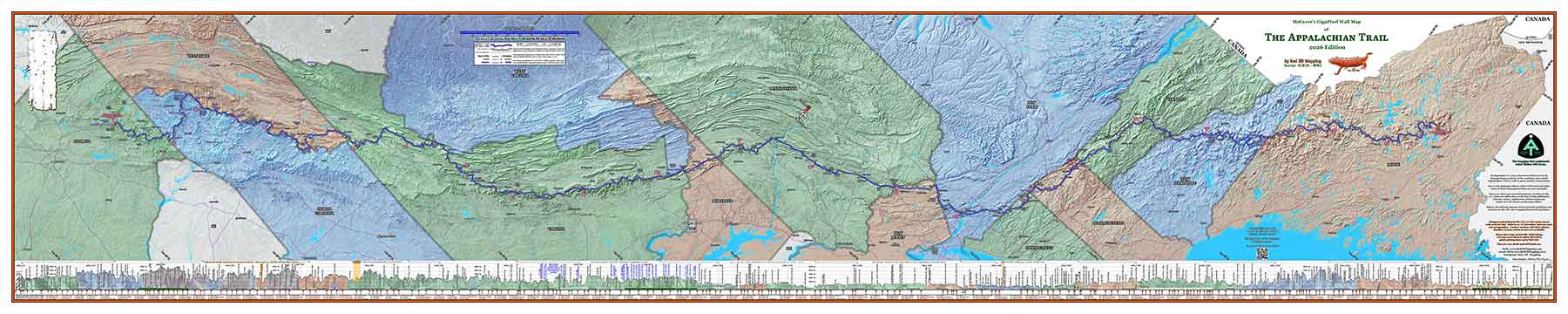
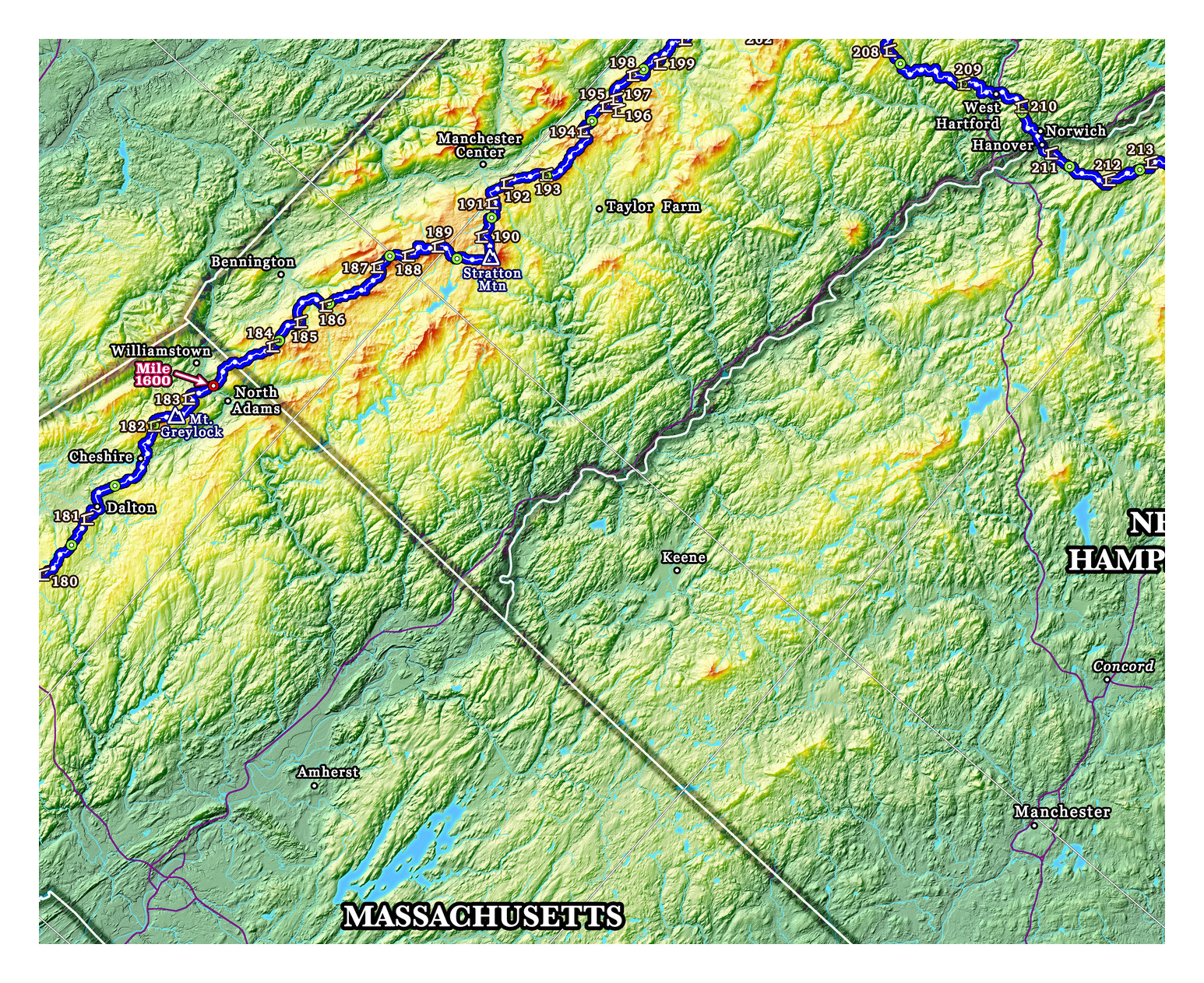
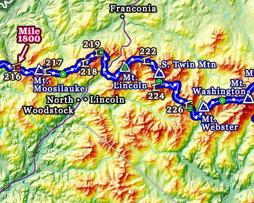
The first color scheme choice has the states colored with one of three background colors to easily distinguish them. The 14 states that the Appalachian Trail passes through will be a shade of blue, green, or brown, while the non-A.T. states that appear on the map are a gray color. Overlaid on top of each state’s background color is a very detailed terrain “hillshading” which makes the topography stand out.
Below is what the overall map looks like with this coloring:
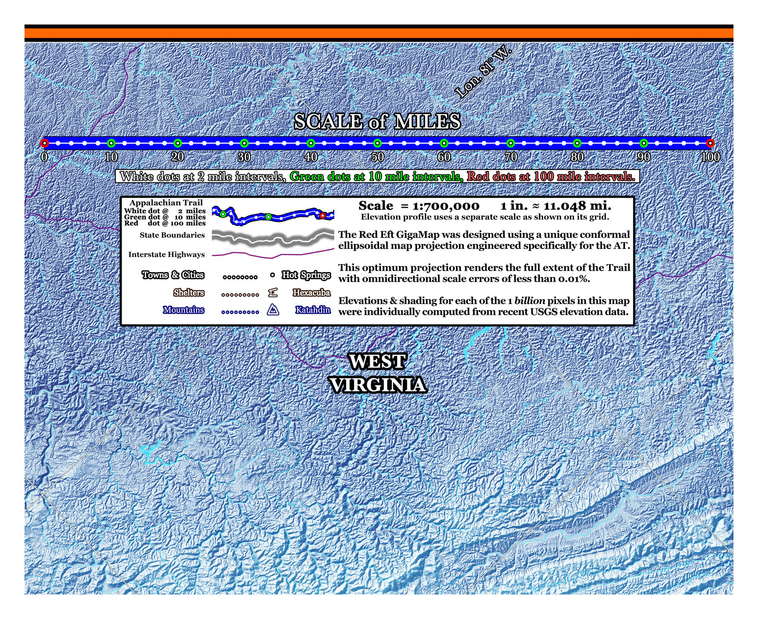
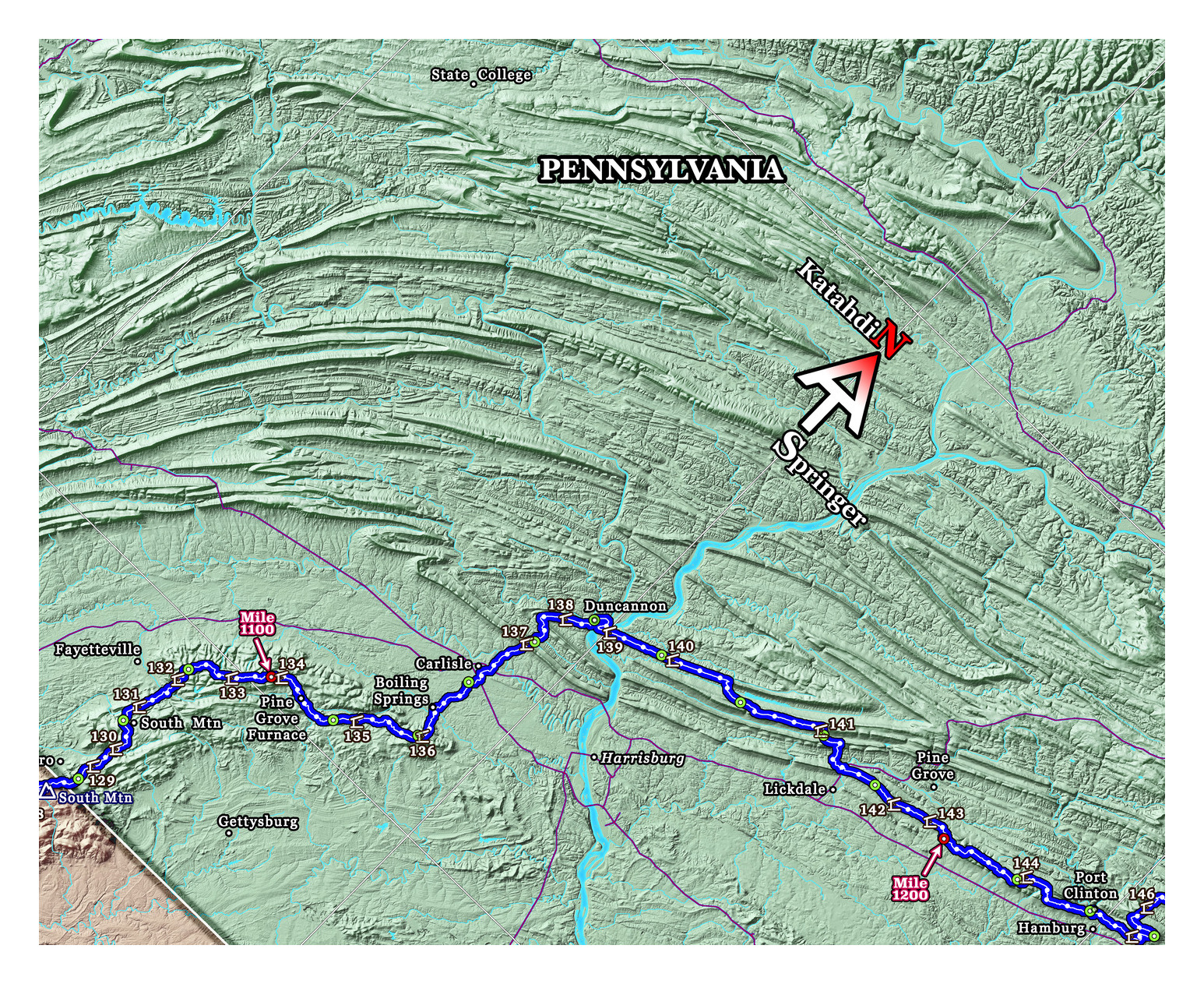
More detailed samples of various parts of the map with this coloring option are shown below:


You may also visit the State Colored Map detail page to zoom around a watermarked version of this map.
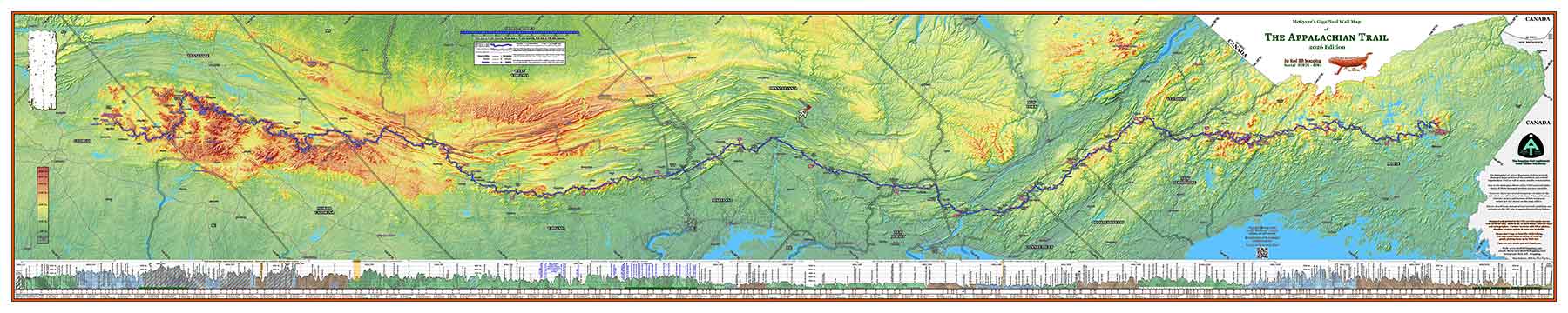
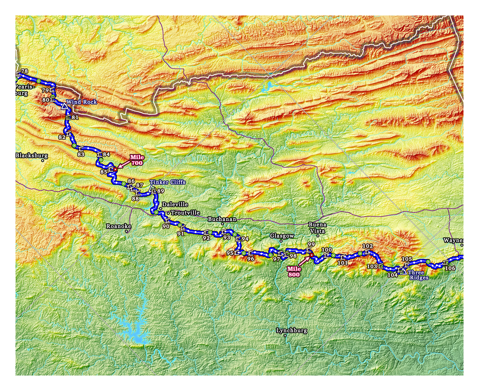
The other color scheme offered has the background color of the entire map based on elevation. The technical term for the elevation based coloring scheme is called hypsometric coloring. In this version of the map, the lowlands are a deep green, which transitions to a lighter green as elevations increase, then to a yellow, then shades of orange and reds. As with the other color scheme choice, detailed hillshading is overlaid over the background coloring to show the topography with amazing detail.
Below is what the overall map looks like with the hypsometric coloring option:
Samples of various parts of the map with the hypsometric coloring option are shown below.
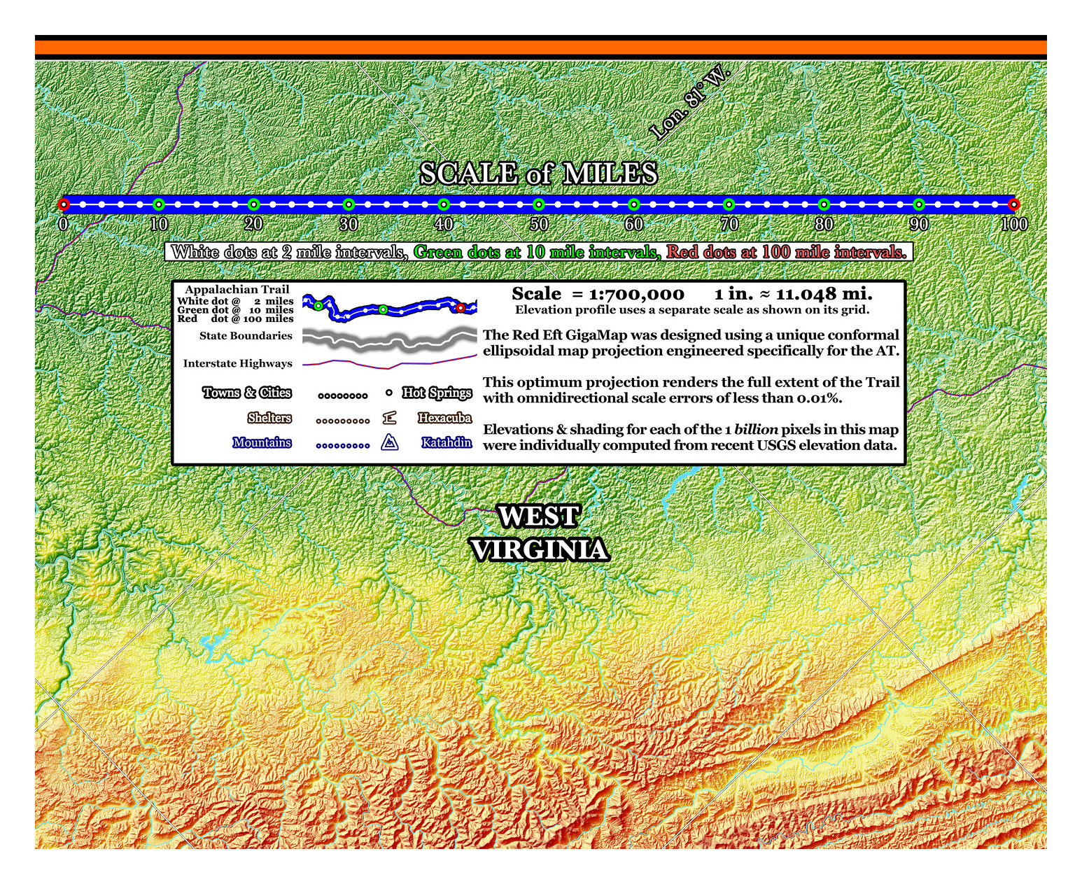
On either coloring version of the map, there is an elevation profile of the entire 2,197.9 mile Appalachian Trail (2026 A.T. Data Book mileage), with hundreds of marked geographic landmarks. The coloring of the elevation profile is the same for both map color schemes, so the state boundaries clearly stand out on the elevation profile. Samples of various parts of the elevation profile are shown below.
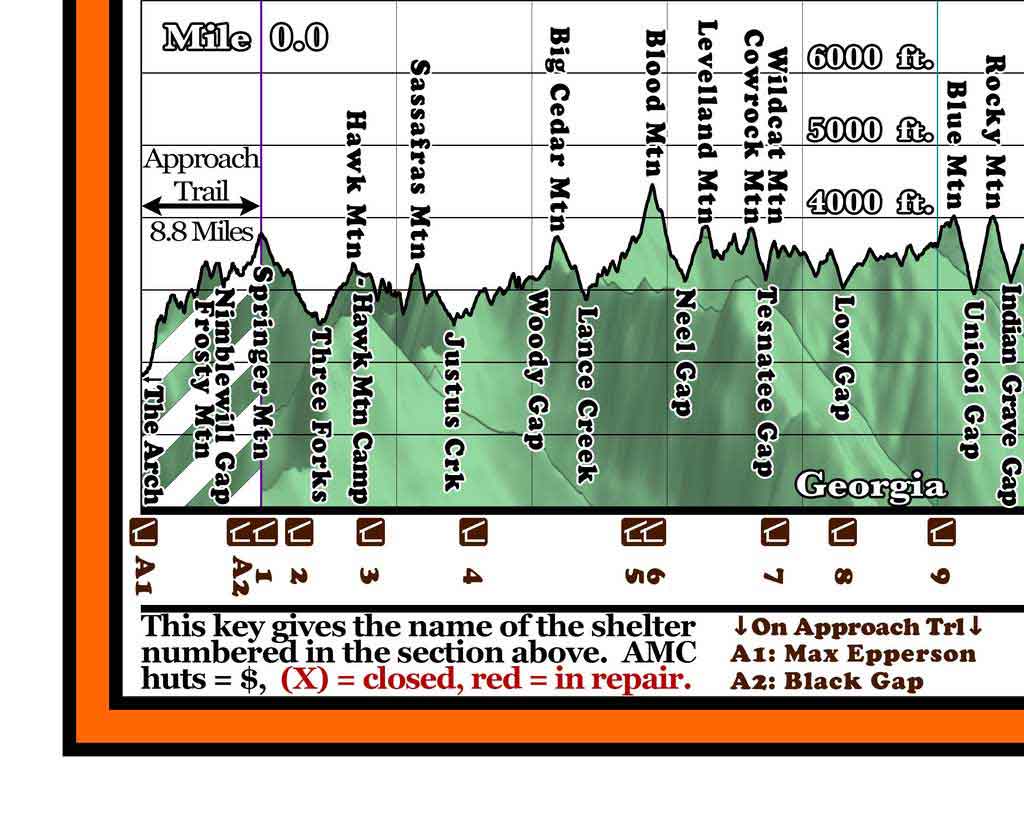
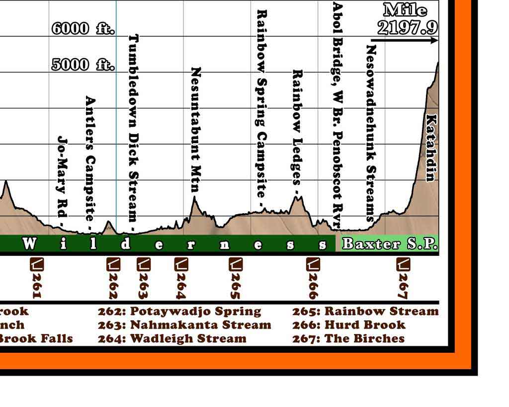
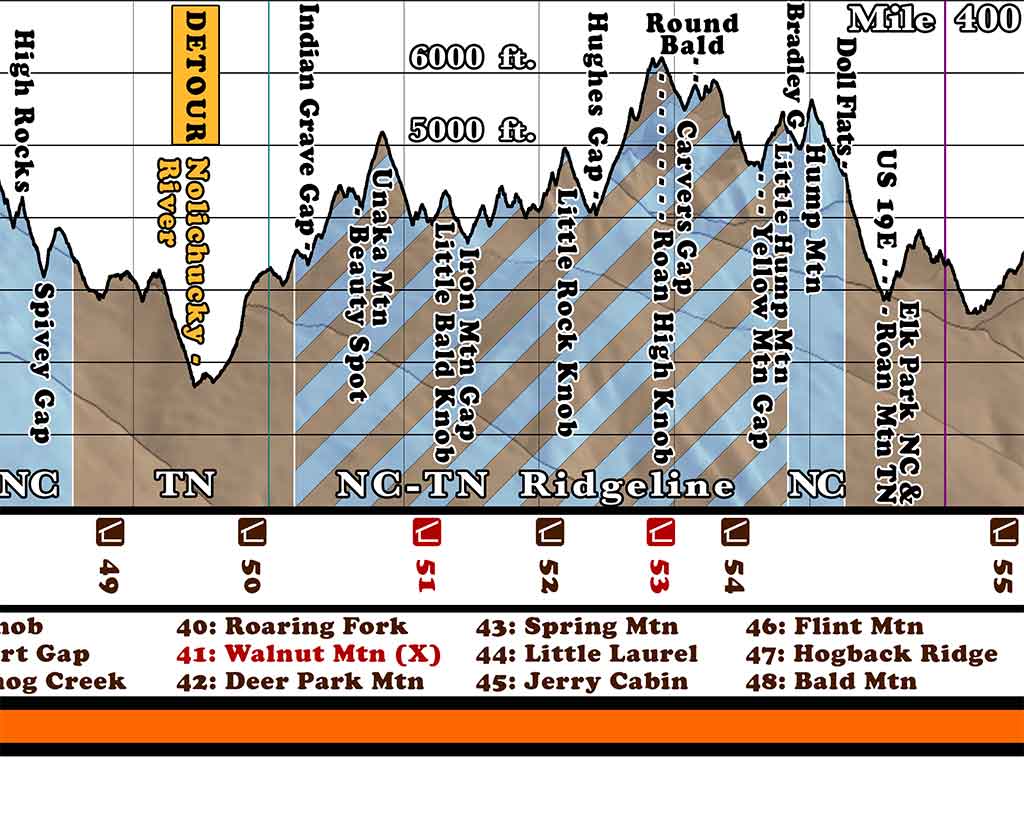
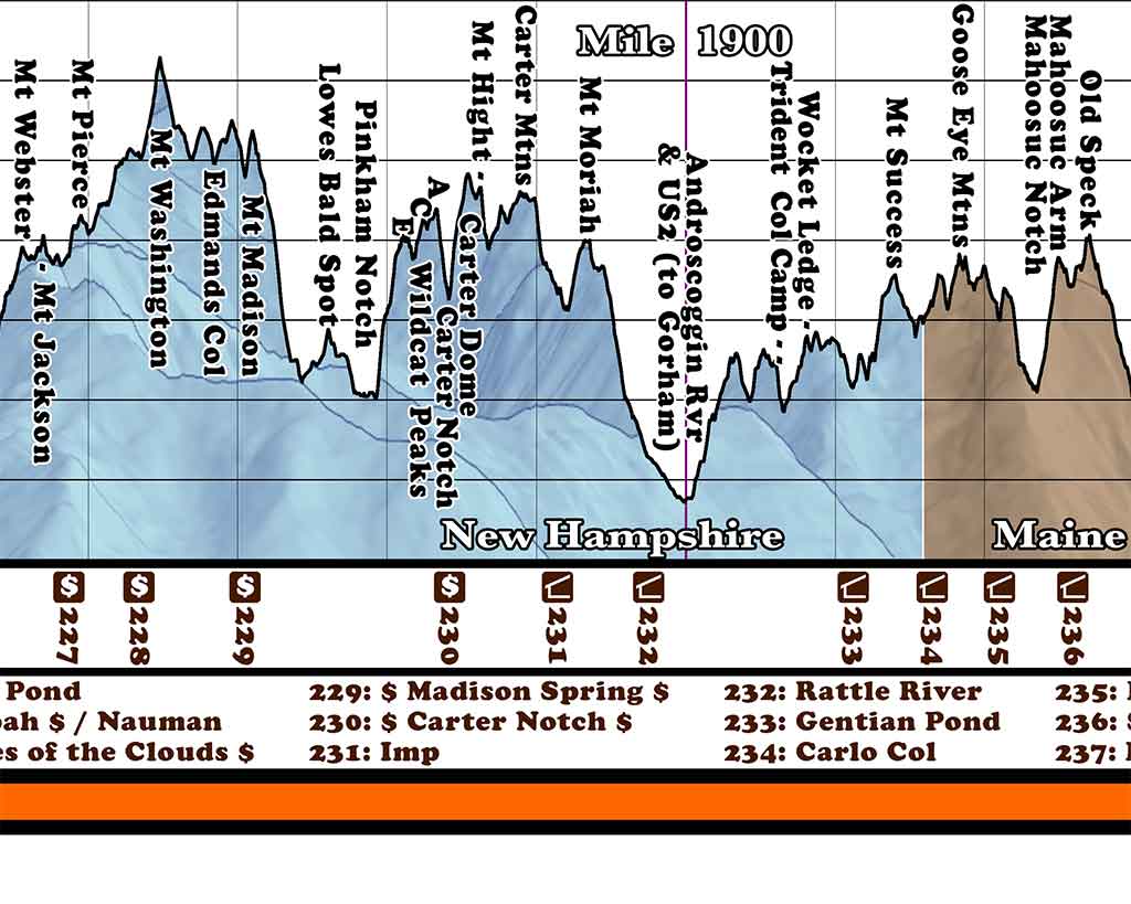
Right-click any image to view more detail.