The PhotoBar on your Map
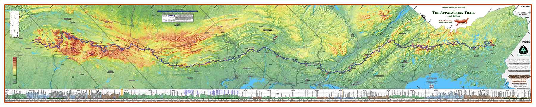
Your PhotoBar is a map-wide (10 feet!) strip of photos which document your AT story. It will be located on your map in a strip below the elevation profile of the trail. Depending upon how the photos are cropped, usually we can fit roughly 50 photos in the PhotoBar. Each photo on the strip will be exactly 2″ tall, and there is space below the photo for captioning.
Three examples from actual hiker maps are shown below. Use the controls below the image window to pan and zoom around the images. On a smartphone, it is best to turn the phone sideways to landscape mode for the best viewing.
On the far left of the images are the trail names of these hikers, and their hiking dates. Note that the image in this window displays PhotoBars from three separate hikers.
All PhotoBars displayed here are used with the permission of the map owners.
NOTE: For mobile users, it is best to rotate your phone or tablet sideways to Landscape mode for best viewing of these images.
If you would prefer to view these PhotoBars in movie form, there are movies you can play below. Just click on the play button, and let the movie play for you as you see a hiker journey north from Springer Mtn, Georgia to Mt. Katahdin in Maine.
Note: NoBo refers to a NorthBound Appalachian Trail hiker – a hiker who is walking north from Springer Mountain, Georgia to Mt. Katahdin, Maine.
Another example below is from 2019 AT thru-hiker ‘ADD’:
And a final example is from 2019 AT thru-hiker ‘Nature Boy’:
The examples shown above of actual 10′ long PhotoBars on the maps of several AT thru-hikers will give you an idea of what you might want to include on your own map. You get bonus points for snarky captions.