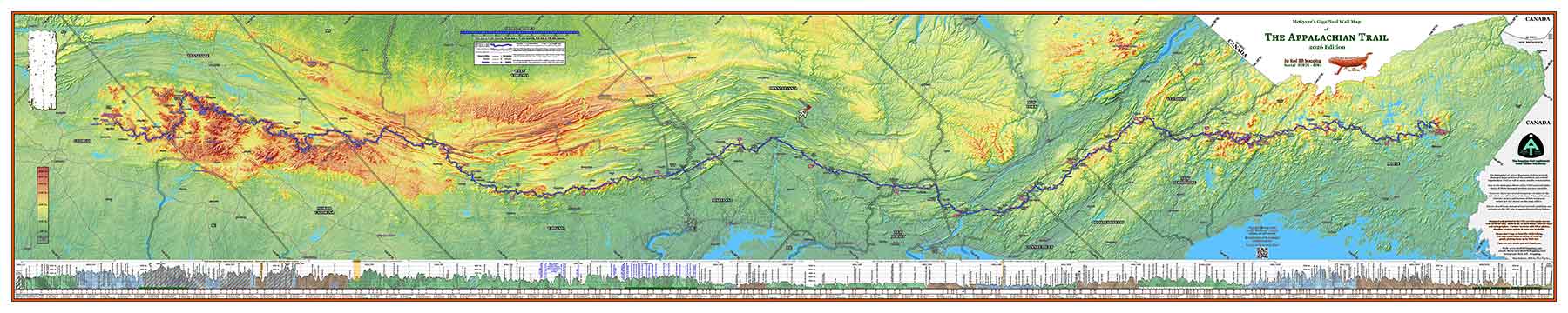
State Colored Map Detail
In the window below, you can explore a bit of the finer detail map with the states individually colored.
Use the toolbar controls to pan and zoom in the image. In a device with a touch interface, you may scroll and zoom with your fingers using the normal gestures. Note that the embedded image is merely 1/16 resolution of the actual source file, and is also JPEG compressed with watermarking. The actual image on your map is extremely crisp, and of course has no watermarking.
Unfortunately, due to past incidents with copyright infringement, we have had to heavily watermark the sample map shown on this page.